


Precinct 105, Carson City, Nevada
About
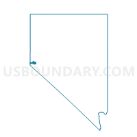
Outline

Summary
| Unique Area Identifier | 616168 |
| Name | Precinct 105 |
| County | Carson City |
| State | Nevada |
| Area (square miles) | 37.84 |
| Land Area (square miles) | 25.76 |
| Water Area (square miles) | 12.08 |
| % of Land Area | 68.08 |
| % of Water Area | 31.92 |
| Latitude of the Internal Point | 39.14854750 |
| Longtitude of the Internal Point | -119.91299840 |
Maps


Graphs
Select a template below for downloading or customizing gragh for Precinct 105, Carson City, Nevada


Neighbors
Neighoring Voting District (by Name) Neighboring Voting District on the Map
- Voting District 50505, Placer County, CA
- Precinct 103, Carson City, NV
- Precinct 107, Carson City, NV
- Precinct 35 - Glenbrook, Douglas County, NV
- Precinct 409, Carson City, NV
- Precinct No. 8111, Washoe County, NV
- Precinct No. 9111, Washoe County, NV
- Voting Districts not defined, Washoe County, NV
- Voting Districts not defined, Douglas County, NV
Top 10 Neighboring County Subdivision (by Population) Neighboring County Subdivision on the Map
- Carson City CCD, Carson City, NV (55,274)
- Washoe Valley CCD, Washoe County, NV (12,741)
- Lake Tahoe CCD, Placer County, CA (10,448)
- Incline Village CCD, Washoe County, NV (9,087)
- Zephyr Cove CCD, Douglas County, NV (5,402)
Top 10 Neighboring Place (by Population) Neighboring Place on the Map
Top 10 Neighboring Unified School District (by Population) Neighboring Unified School District on the Map
- Washoe County School District, NV (421,407)
- Carson City School District, NV (55,274)
- Douglas County School District, NV (46,997)
- Tahoe-Truckee Joint Unified School District, CA (31,699)
Top 10 Neighboring State Legislative District Lower Chamber (by Population) Neighboring State Legislative District Lower Chamber on the Map
- Assembly District 4, CA (536,793)
- Assembly District 26, NV (69,333)
- Assembly District 39, NV (53,415)
- Assembly District 40, NV (49,877)
Top 10 Neighboring State Legislative District Upper Chamber (by Population) Neighboring State Legislative District Upper Chamber on the Map
- State Senate District 1, CA (1,002,597)
- Washoe County Senatorial District 4, NV (110,453)
- Capital Senatorial District, NV (102,155)
Top 10 Neighboring 111th Congressional District (by Population) Neighboring 111th Congressional District on the Map
Top 10 Neighboring Census Tract (by Population) Neighboring Census Tract on the Map
- Census Tract 3, Carson City, NV (3,806)
- Census Tract 2, Carson City, NV (3,526)
- Census Tract 1, Carson City, NV (3,034)
- Census Tract 33.09, Washoe County, NV (2,546)
- Census Tract 32.04, Washoe County, NV (2,522)
- Census Tract 16, Douglas County, NV (1,591)
- Census Tract 9900, Carson City, NV (0)
- Census Tract 9900, Douglas County, NV (0)
- Census Tract 9900, Placer County, CA (0)
- Census Tract 9900, Washoe County, NV (0)